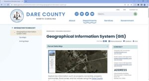
 It’s amazing today what you can find on the Internet. Dare County Government is a very good source of Outer Banks property information. The Dare County GIS (Geographical Information System) department has all kinds of good information that both visitors and locals will need at some point. So what is GIS?
A large part of GIS is aerial photographs that you can manipulate on-line to see different types of information. Layers of information are placed on top of the aerial photographs of the county. This post will show you some of what’s available and how to effectively use some of what’s provided by Dare County government. Here’s a video on what’s available.
Dare County Parcel Data
Probably the most used map is the parcel data map. Here you can search by owner’s name, an address or a parcel number and get what’s available in the county tax records. In many cases that will include a picture of the property, some size and building age information as well as dimensions of the land. Here’s a video on how to use that data.
Dare County Flood Zone Swipe Map
The Federal government revises their flood maps on a regular basis. In the past new revised maps have been created about every ten years. Why would these maps change? Occasionally new information will come out that helps the government determine what areas flood. For example, Hurricane Isabel in 2003 had some places flood that had not flooded since the Ash Wednesday storm. Data from that hurricane was used to create new maps. Prior to the latest revision, more accurate property elevations became available. That information was used in the revision that was approved in June of 2020. One reason for this swipe map is to show the previous map that was based more on historical floods than accurate elevations. Some municipalities also use the older maps during the building permit process. Here’s a video on how to use that map.
Dare County Recreational Map
Somewhere around 80% of Dare County is owned by the federal, the state or a local government. Of course there’s a ton of things to do outside here. This map has all kinds of good information about things to do outside. From beach accesses, where lifeguards are, handicap access to the beach to parks, skate parks, dog parks, multi-use paths and trails. If you are coming to the Outer Banks for vacation or if you just want to get to know the area better then this is a great resource. Check out how to use this map here.
Dare County’s GIS web page will likley change as more information is added and improved upon. If you love the Outer Banks or are interested in Outer Banks real estate then it’s a good idea to bookmark the Dare County GIS page.


Leave a Reply